Remember!
Always tell someone where you’re going and when you expect to be back. This is just good hiking sense, no matter where you go.
Bring plenty of water — and drink it as you go. Some basic first aid supplies are always a good idea, too, as are some snacks.
Wear shoes that are designed for hiking.
Dress or pack for all possible weather conditions forecast for the day. Layers are the wisest way to dress for the outdoors — you can add or remove as you go. We also recommend long-sleeved clothing, even in warmer weather. Poison ivy thrives on the Palisades. Ticks are common. Long clothing with a spray of repellent at the cuffs is your best defense.
The Palisades Trail System
There are seven marked hiking trails in the park, each identified in the field by colored rectangular markers.
Trail marker on the Long Path.
Two Main Trails:
The cliff-top Long Path and the riverfront Shore Trail each run the south-to-north length of the park. Both are National Recreation Trails.
Palisades Shore Trail (white markers)
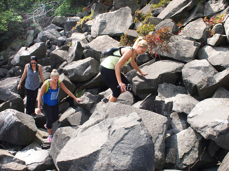
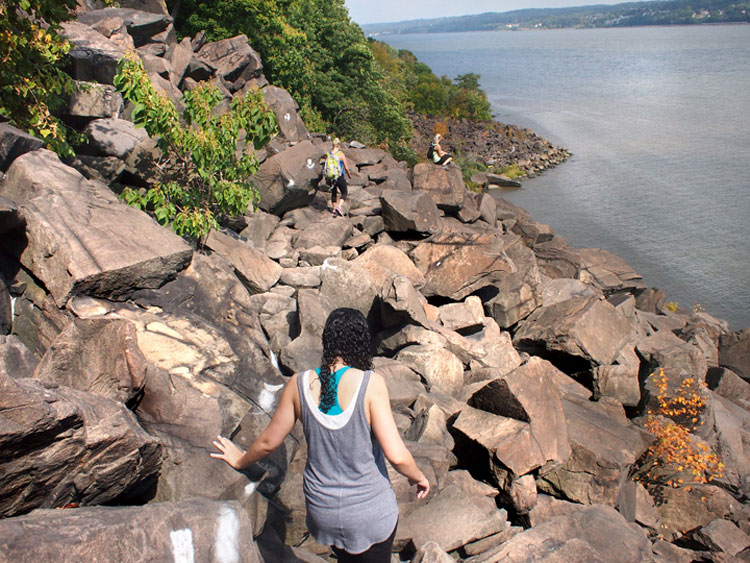
12 mi., easy to challenging hiking with some rocky sections, then a very challenging rock scramble & steep climb to the northern trailhead
The Shore Trail is accessible from all of the park’s riverfront picnic areas as well as from the eastern (downhill) trailheads of the five connecting trails in the park (see below). From the Edgewater park entrance, the Shore Trail descends to and then follows the river north. North of Alpine Picnic Area , the Shore Trail enters a more remote section of the park, eventually traversing the almost mile-long challenging rock scramble known as the “Giant Stairs,” before it ascends again with a steep climb to meet the Long Path.
Nearest bus stop for Shore Trail southern trailhead = Fort Lee Bridge Plaza (served by numerous area bus lines).
Nearest bus stop for Shore Trail northern trailhead = U.S. Route 9W at Lamont (served by the Rockland Coaches No. 9 buses).
Five Connecting Trails:
These trails link summit (Long Path) to riverfront (Shore Trail), and along with both ends of the Shore Trail, they allow hikers to create loop hikes that include both summit and riverfront segments.
Carpenter’s Trail (blue markers)
Steep: 320-ft. climb
Providing park access to hikers from the west side of Hudson Terrace by Linwood Park in Fort Lee, Carpenter’s Trail ascends a stairway to a sidewalk along the Parkway overpass and then crosses a short pedestrian bridge to a stairway that enters the woods on the east side of the Parkway. It briefly overlaps with the Long Path, then descends on steep treadways to a tunnel beneath Henry Hudson Drive, from which it descends on stone steps to the Shore Trail just south of Ross Dock Picnic Area .
Some street parking available near western trailhead — follow all posted (Fort Lee Boro) regulations for parking!
Nearest bus stop = Fort Lee Bridge Plaza (served by numerous area bus lines).
Dyckman Hill Trail (yellow markers)
Moderate: 340-ft. climb
Photo: Denise Riordan.
Providing park access to hikers from the Englewood Cliffs park entrance, where the Long Path crosses Palisade Ave., the Dyckman Hill Trail descends on treadways and stone steps to the Shore Trail near the entrance to Englewood Picnic Area .
Nearest bus stop = U.S. Route 9W (Sylvan Avenue) at Palisade Avenue (served by the Rockland Coaches No. 9 buses).
Huyler’s Landing Trail (red markers)
Moderate: 440-ft. climb
Beginning from the Long Path about a quarter mile south of Alpine Lookout, the Huyler’s Landing Trail follows a steep old wagon road to the river, overlaps Henry Hudson Drive for about 100 yards (use caution here!), then switches back to the Shore Trail about 1 mile south of Alpine Picnic Area .
Nearest bus stop = U.S. Route 9W at Greenbrook (served by the Rockland Coaches No. 9 buses).
Closter Dock Trail (orange markers)
Moderate–Steep: 360 ft. climb
Providing park access to hikers from a pair of underpasses that cross beneath the Palisades Interstate Parkway from US Route 9W just north of Closter Dock Road, the Closter Dock Trail overlaps the Long Path for about a quarter mile, crosses beneath Henry Hudson Drive through another (much smaller) underpass, then descends on a steep old wagon road to the Shore Trail just north of Alpine Picnic Area .
Roadside parking available on U.S. Route 9W at western trailhead.
Nearest bus stops = U.S. Route 9W at Closter Dock Road & Old Dock Road (served by the Rockland Coaches No. 9 buses).
Forest View Trail (blue-and-white markers)
Steep: 520 ft. climb
Providing park access to hikers from a pedestrian bridge crossing over the Palisades Interstate Parkway from US Route 9W near the Alpine Boy Scout Camps, the Forest View Trail overlaps the Long Path by the Women’s Monument , then descends on steep stone steps and treadways into a remote section of the park to the Shore Trail just south of the Giant Stairs (approx. 2.25 mi. north of Alpine Picnic Area ).
Roadside parking available on U.S. Route 9W at western trailhead.
Nearest bus stops = U.S. Route 9W at Ruckman Road & Camp Alpine (served by the Rockland Coaches No. 9 buses).
The Ski Trails
Available to hikers year-round, about 5 miles of designated cross-country ski trails of various lengths and difficulty are at State Line Lookout . Marked A – F, these trails are maintained for winter use but not groomed. Skiers are advised to wait for at least 4 inches of snow before using the trails. We do not offer ski rentals. Click here to download a map of our cross-country ski trails . Skiers can also use our hiking trails, but many of these trails are steep or rocky — skiers should scout these trails by foot before attempting to ski them!